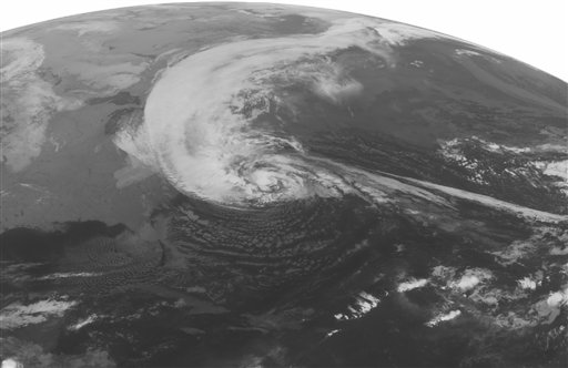
This NOAA satellite image taken Monday, Oct. 29, 2012 at 1:45 a.m. EDT shows Hurricane Sandy turning to the to the north well east of Cape Hatteras, N.C. Maximum winds are 75 mph with slight strengthening possible in the next 12 hours. Sandy is spreading rain and high winds across the Mid Atlantic and New England and is expected to make landfall later today on the southern New Jersey coast. Wind gusts as high as 80 mph can expected from southern New England to the Washington area. Storm surges of 6 to 10 feet are expected in the New York City area, Long Island, and the New Jersey coast. Heavy snow will develop over the mountains of West Virginia, eastern Kentucky, and southwestern Virginia with 1-2 feet expected. (AP Photo/Weather Underground)
© FOX News Network, LLC. All rights reserved.


